Altura del rio সম্পর্কে
Description of "Altura del rio" Application
"Altura del rio" is a comprehensive application designed to provide real-time information about river levels and environmental conditions in the Paraná Delta in Tigre and Rio de la Plata. This app offers detailed insights into various aspects of the river, including its height, temperature, wind conditions, tides, and more.
Real-Time River Level Data
You can find out about the current status of the river directly from your device. The application provides real-time updates on river height, temperature, wind, tides, and other relevant parameters.
Tide Stations
The application monitors tide stations located at multiple points:
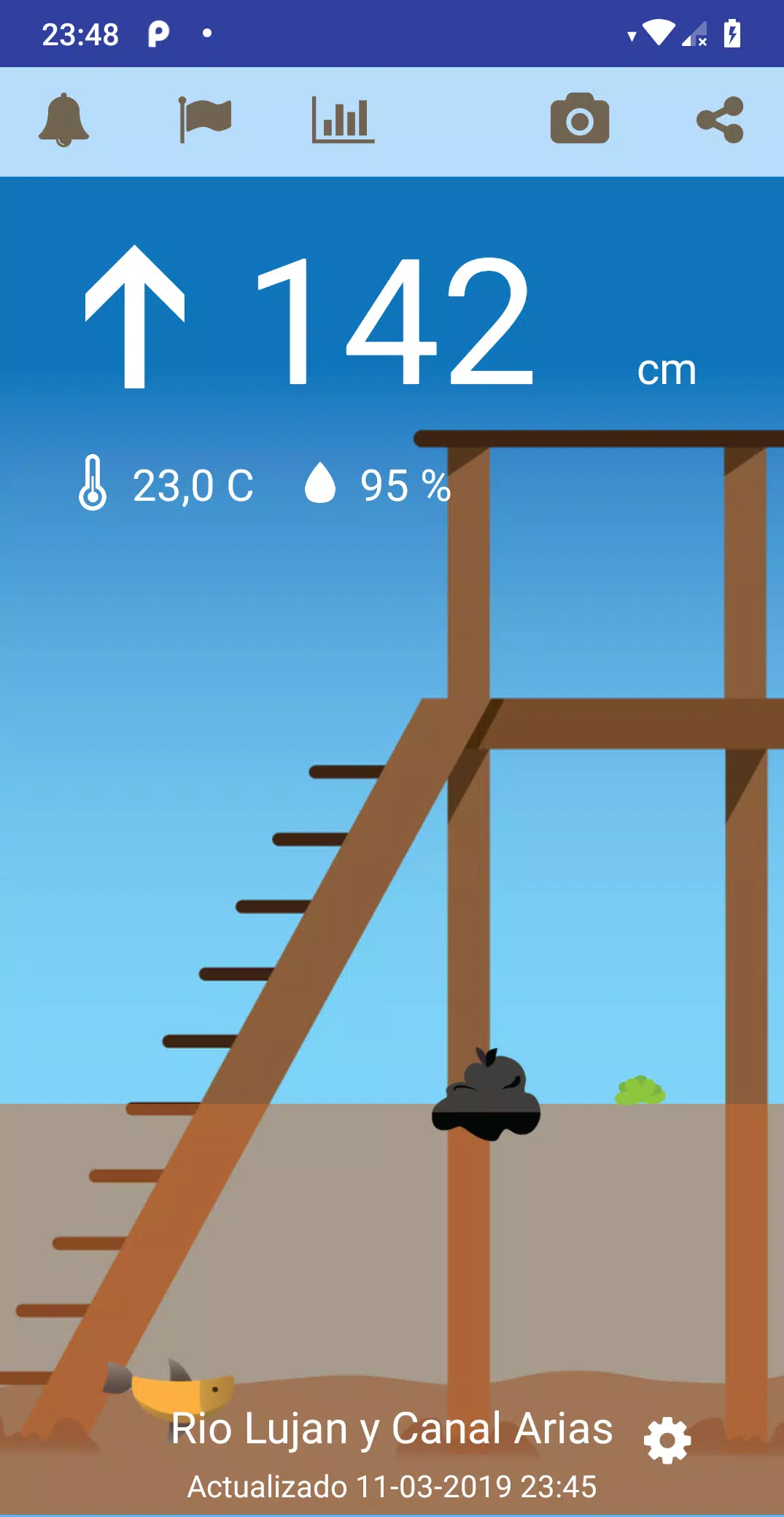
- Rio Lujan and Canal Arias: These stations are situated near Villa la Ñata and Dique Lujan.
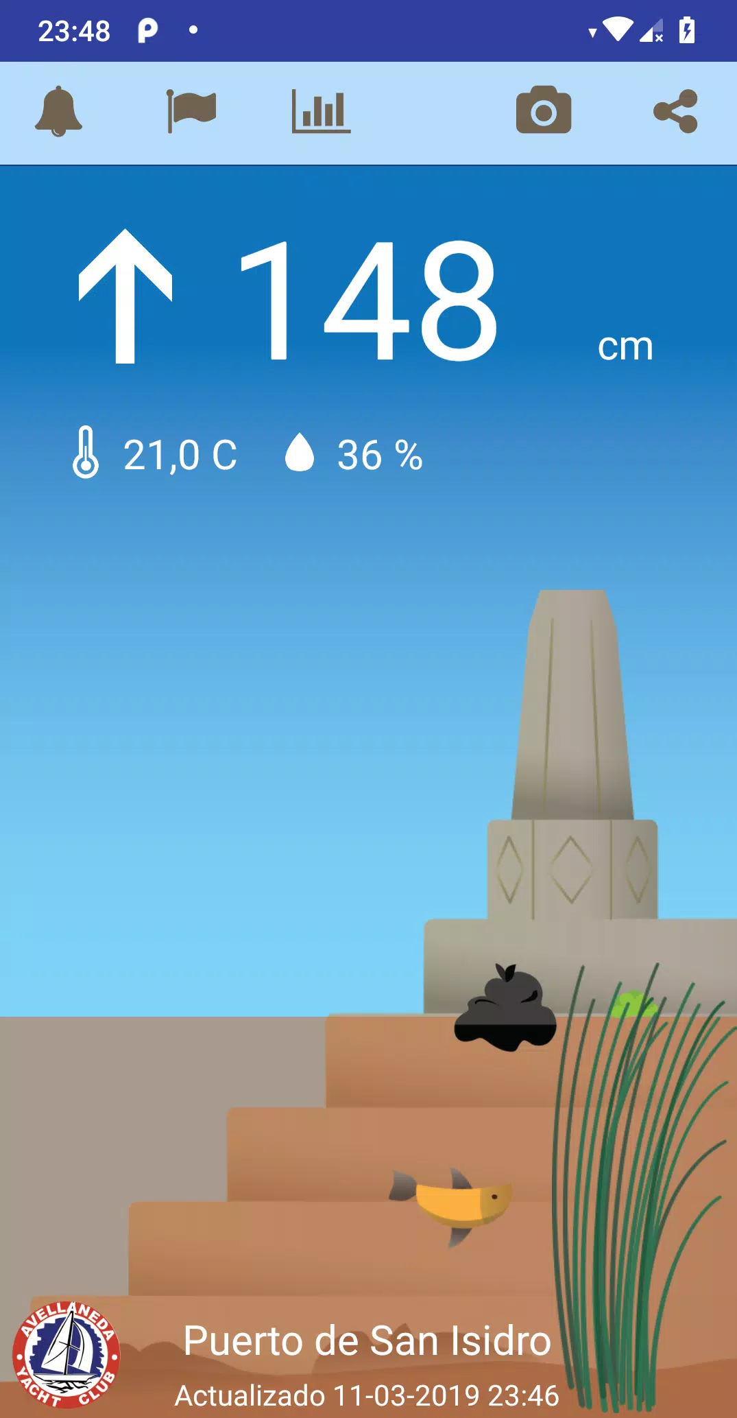
- Port of San Isidro: Another critical location for monitoring tidal changes.
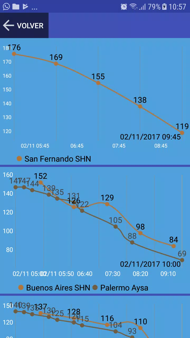
Reports on River Height
The application generates reports on the height of the Rio de la Plata at several key locations:
- Delta first section
- San Isidro
- San Fernando
- Buenos Aires
- La Plata
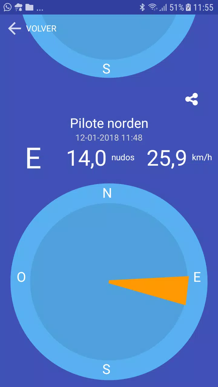
- Pilote Norden
Widget Integration
A widget is available to display the river height directly on the initial screen of your device, making it easily accessible.
Wind Information
Wind conditions are also monitored in real-time at various points:
- Sunset Point
- Club Avellaneda in San Isidro
- Windguru station in San Isidro
- La Plata
- Pilote Norden
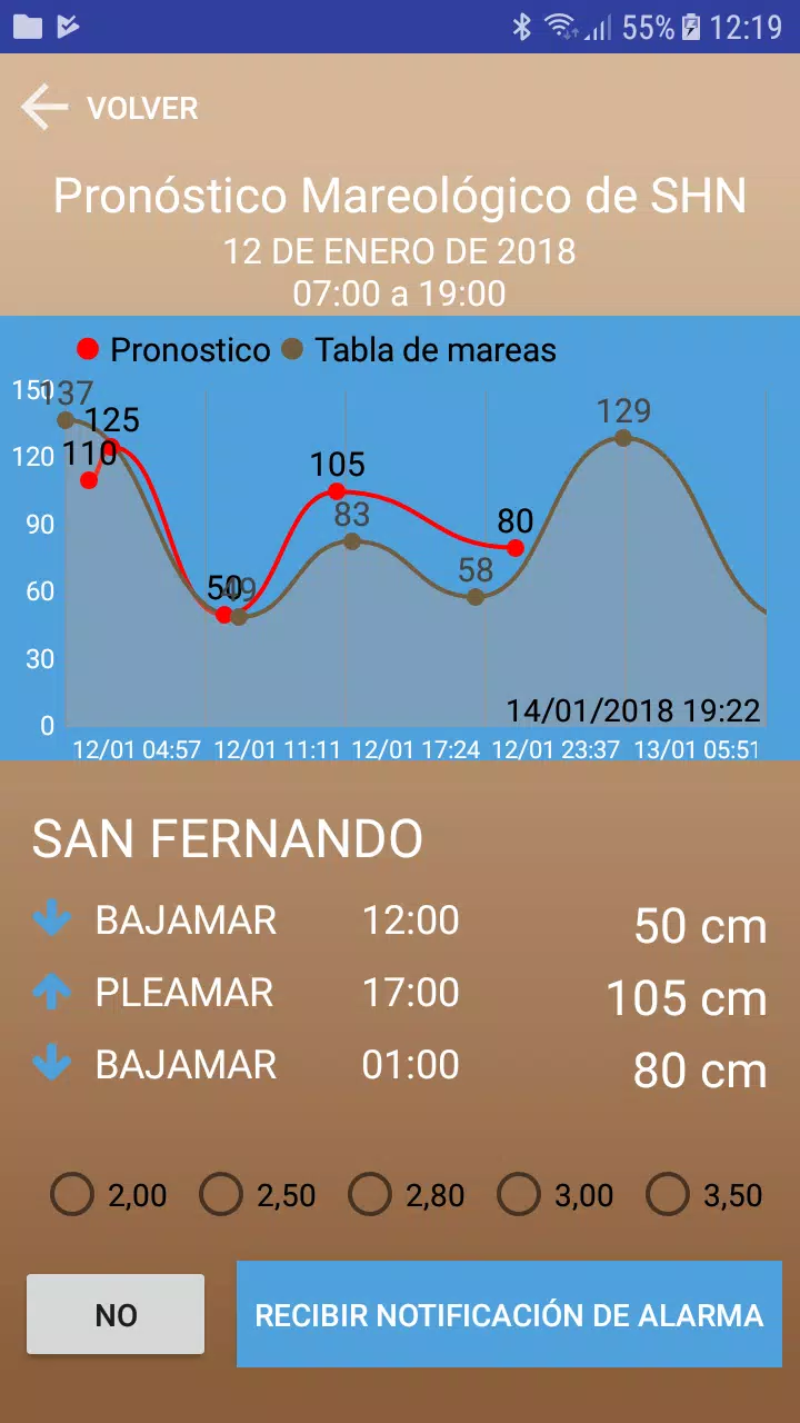
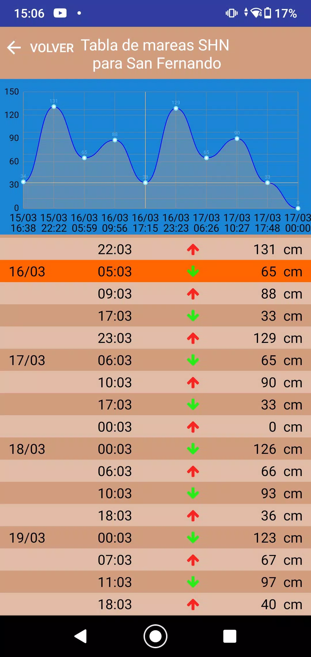
SHN Naval Hydrography Service Tidal Forecast
The application integrates tidal forecasts provided by the SHN Naval Hydrography Service, ensuring users have access to reliable predictions.
Alerts and Notifications
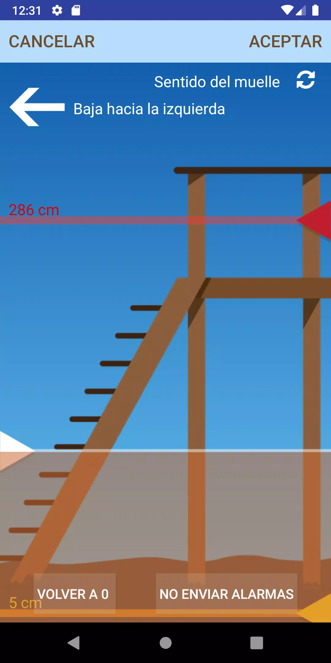
Users can set alerts and notifications for specific river levels or conditions. When the Pleamar forecast exceeds a certain level, or when the river level reaches a predefined threshold, the app will notify you immediately.
Graphical Data
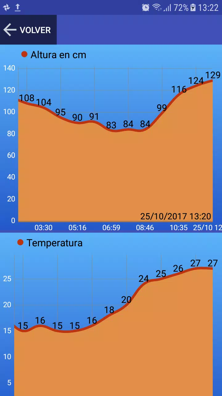
Historical data and forecasts are presented through graphical representations:
- Historical river height for the past 24 hours
- Historical forecast and tide data
New Features
Recent additions include:
- Tide Table in San Fernando: This table uses a digital tide gauge located near the confluence of Rio Lujan and Canal Arias, displaying the level in centimeters.
- Current Temperature and Humidity: Real-time temperature and humidity readings in the Delta region.
Environmental Indicators
The application includes indicators such as arrows to show whether the water level is rising or falling, and even visualizes how fish and plants move with the river's current.
Photo Sharing
Users can capture photos and overlay them with relevant data, making it easy to share this information with others.
Customization Options
You can customize the water level displayed according to the actual spring, and adjust the direction of the spring or the current flow.
Practical Applications
With this information, you can determine:
- Whether there is enough water in the park of your house or if it covers the dock.
- If the canal is navigable due to water levels.
- If the marina is accessible.
- If the streets of Tigre and Rincon de Milberg are starting to flood.
- Whether it's a good time for fishing.
- If it's suitable for rowing.
- Whether navigation outside the canal is possible.
Support and Resources
For any issues, doubts, suggestions, or errors, please contact us at buglandapp@gmail.com. Additionally, you can refer to the user manual available at https://www.alturadelrio.com/manual for more detailed instructions.
Follow us on Instagram for updates and additional information: https://www.instagram.com/alturadelrio/