GPS Distance Land Area Measure
About GPS Distance Land Area Measure
GPS Distance Land Area Measure
Overview
The GPS Distance Land Area Measure application is designed to help users measure land areas, distances, and perimeters with precision and ease. Whether you're a professional surveyor, a real estate agent, or simply someone who needs to measure plots of land, this app offers an intuitive solution.
Key Features
- Effortless Measurement: Use this simple and user-friendly tool to measure the size of any area effortlessly.
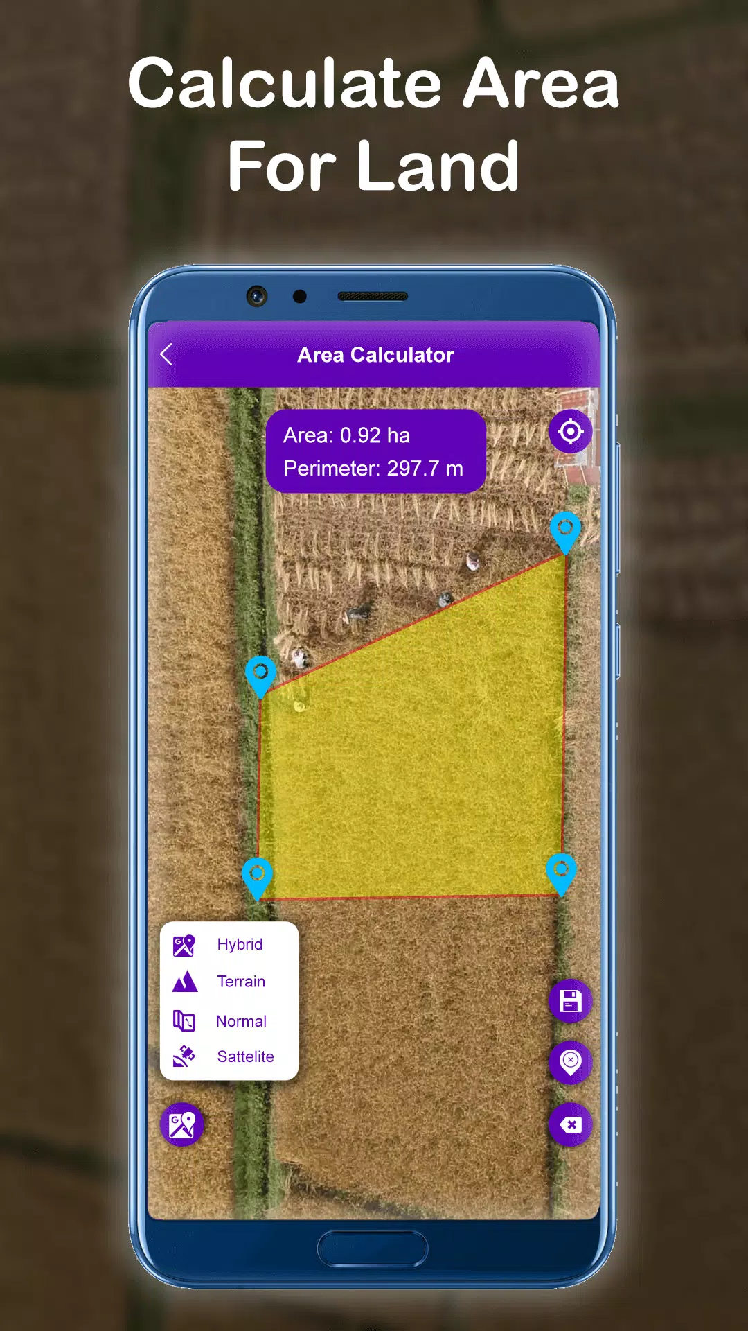
- Land Area Calculation: Our Land Area Measure tool makes it easy to discover the ideal size for any piece of land or area.
- Accurate Results: Choose from manual and GPS methods to ensure your measurements are precise.
- Editing Tools: Save, edit, and modify any selected area using our intuitive editing tools.
- Image Integration: Easily save measurement files by importing photos from your camera or gallery, providing a straightforward way to keep track of your measurements.
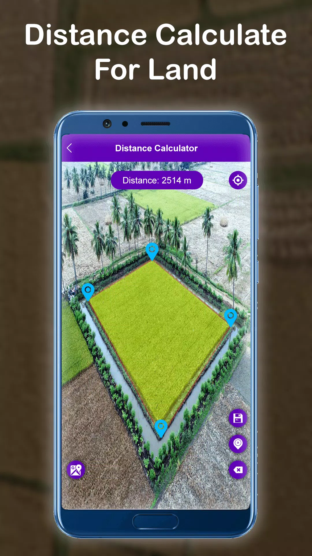
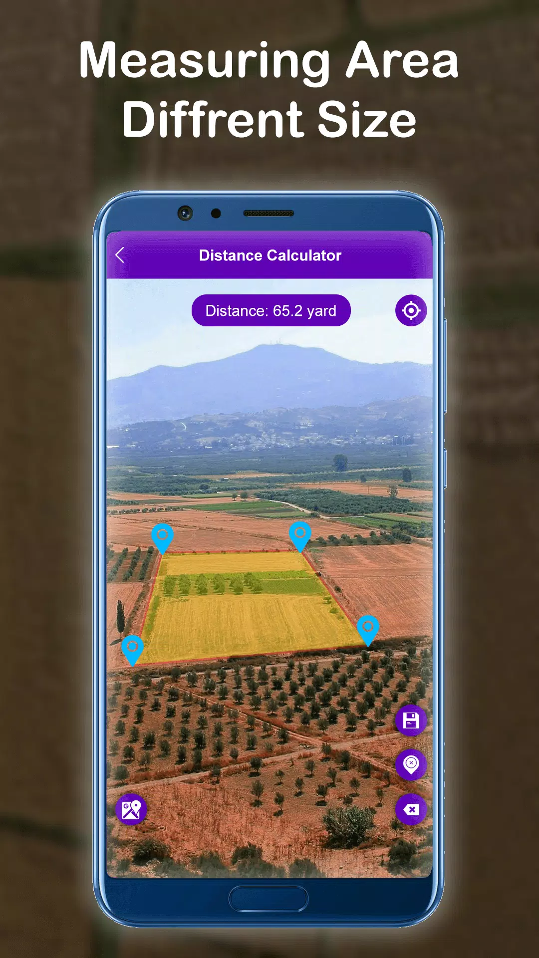
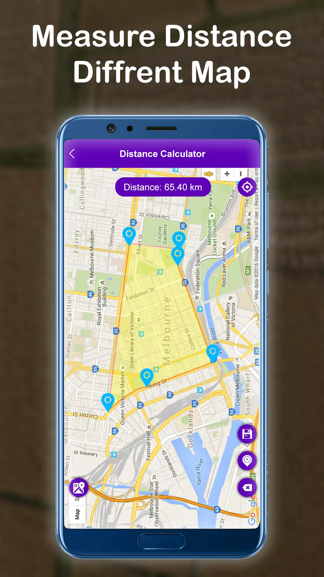
- Distance Measurement: Calculate the distance between two places using our user-friendly manual and GPS measurement tool.
- Points of Interest (POI): Locate POIs with ease using manual and GPS measurements, and view their latitude and longitude coordinates.
- Map Customization: Switch between map types—normal, satellite, terrain, or hybrid—offering added convenience.
- Real-time Measurement: Realtime measuring and calculating between two or more points ensures accuracy.
- User-Friendly Interface: Effortlessly move and drop points on a map with a simple touch.
How It Works
Using the GPS Distance Land Area Measure app, you can measure any place or land area on a map by being at your current location. Simply select the area you want to measure on the map. The app allows you to calculate the distance between two or more points anywhere on Earth. To measure distance and land area, just click on the map to place markers, and correct any mistakes by deleting misplaced points. Zoom in on locations for a closer look if needed.
Once you have completed your measurements, save them easily by entering a name and description for the measurement field. Enhance your data by adding images from your camera or gallery. With the POI feature, selecting locations shows their latitude and longitude coordinates, which you can also save for future reference.
Conclusion
Whether you need to measure large plots of land or small distances, the GPS Distance Land Area Measure app provides a comprehensive and user-friendly solution. Its versatile features make it a must-have tool for anyone involved in land management, real estate, or general mapping tasks.
GPS Distance Land Area Measure Screenshots
Old Versions of GPS Distance Land Area Measure


Apps Like GPS Distance Land Area Measure
 GPS Distance Land Area Measure4.7
 GPS Land Field Area Measure4.8
 Distance - Fields Area Measure4.9
 GLand : GPS Field Area Measure4.5
 GPS Fields Area Measure Tool4.8
 GPS Fields Area Measure PRO4.3
 GPS Fields Area Measure4.7
 Area Measure By GPS4.7
 GPS Area Measure - Mapulator4.9
 GPS Fields Area Measure4.7
 Optometry eye distance measure4.7
 Distance and area measurement4.8