GPS Photo Camera Geotag Photos
GPS Photo Camera Geotag Photos Hakkında
GPS Photo Camera: Geotag Photos with Precision
Are you looking for a way to capture your adventures and preserve them with precision? The GPS Photo Camera is designed to help you add location and timestamp data to your photos effortlessly. Whether you're traveling or simply capturing everyday moments, this app ensures that every picture tells a complete story.
Enhance Your Memories with GPS Stamps
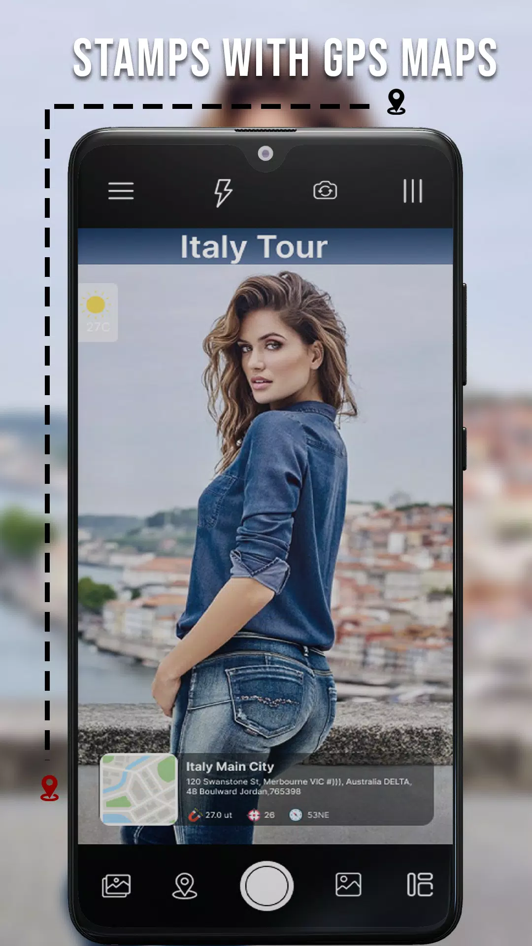
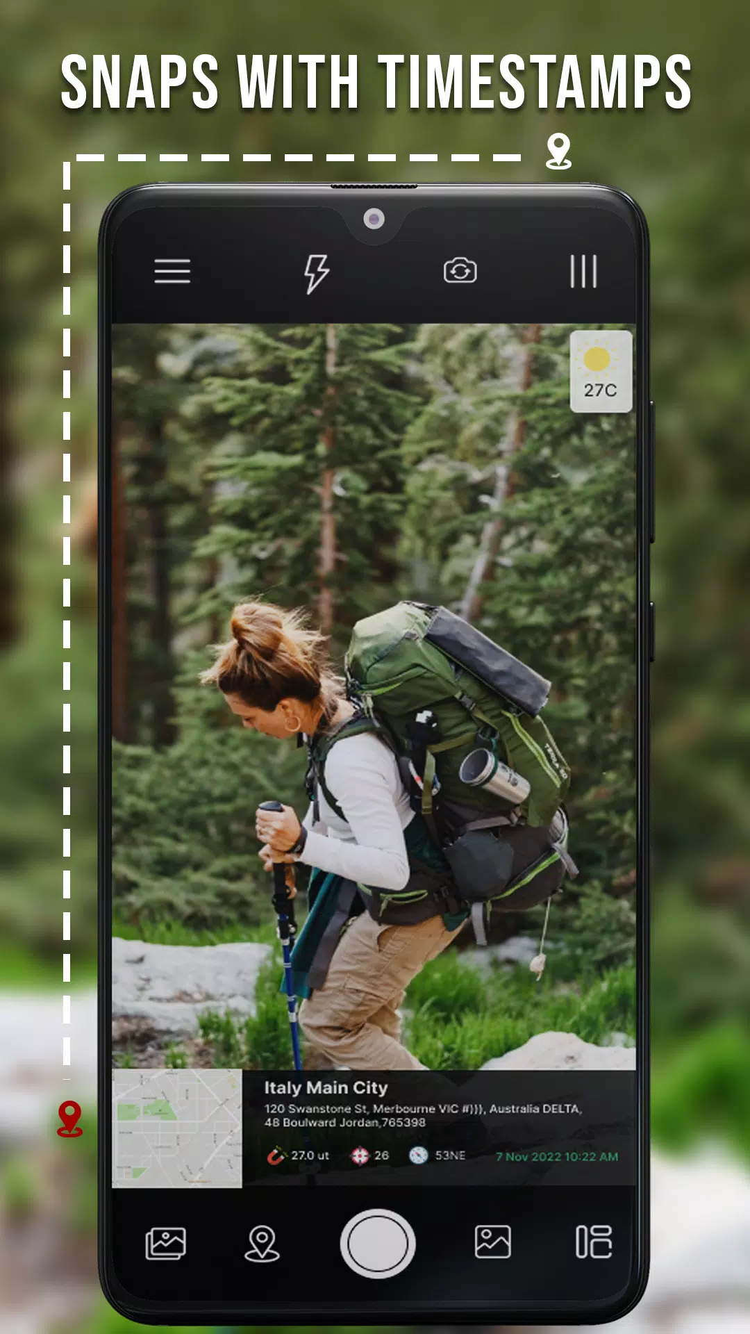
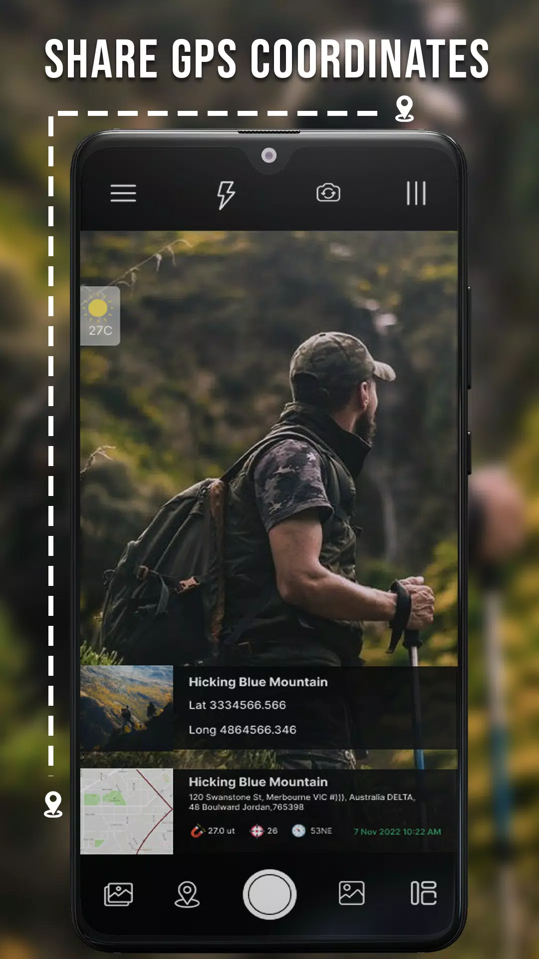
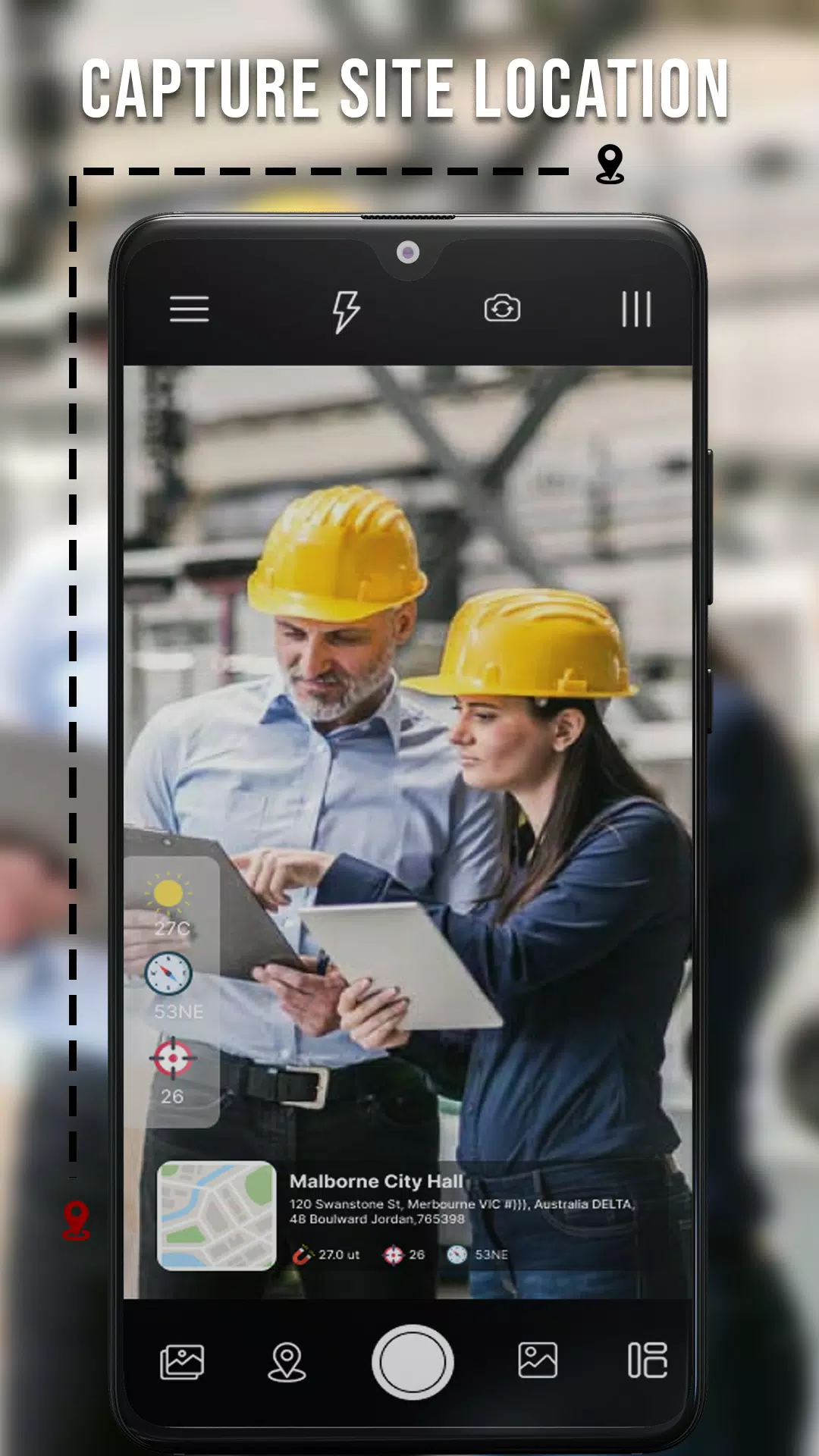
With the GPS Photo Camera, you can add essential details like date, time, map, latitude, longitude, and even altitude to your photos. This app also provides accurate weather conditions, allowing you to capture the essence of each moment accurately. Imagine being able to share not just a picture but a detailed snapshot of where and when it was taken!
Real-Time GPS Tracking and Navigation
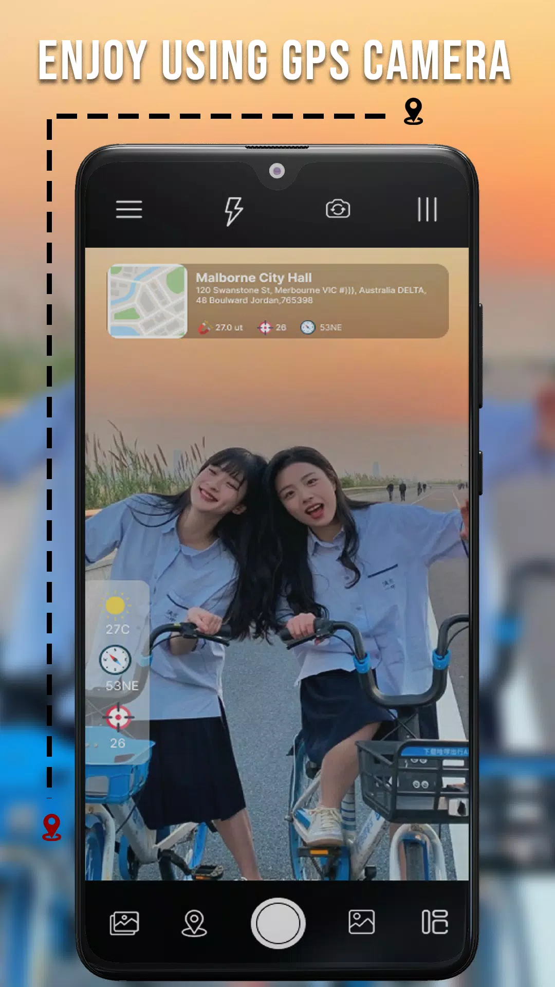
The app offers a live GPS camera map feature that lets you view your route in real-time. This makes it incredibly useful for driving or hiking, as you can easily track your progress and location. The 3D GPS camera feature adds an extra layer of interactivity, making your photos more engaging and informative.
Customizable Features for Every User
Different templates and settings allow you to adjust dialogue size and speed limits according to your preferences. Whether you’re a casual user or a professional photographer, the GPS Photo Camera has something for everyone. You can manually set GPS locations, latitude, and longitude if needed, providing flexibility and control over your photos.
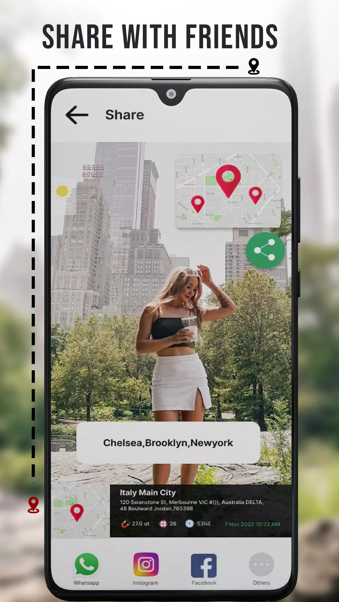
Emergency and Social Sharing
One of the standout features of the GPS Photo Camera is its ability to add GPS location stamps to your photos. This can be particularly useful in emergencies or when sharing your adventures with friends and family. You can share the exact location, longitude, and latitude of where the photo was taken, making it easier for others to understand the context.
Advanced Features for Enthusiasts
For those who appreciate advanced functionalities, the GPS Photo Camera includes features like adding GPS directions to your location images, satellite map stamps, offline map navigation, and compass tracking. These tools make it easier to navigate and document your journeys, even without an internet connection.
How to Use the GPS Map Live Camera
To get started, download the GPS Photo Camera from the Play Store. Once installed, you can select your preferred date and time format, GPS coordinates, and other settings. Then, add GPS location stamps automatically or manually to your photos. It’s simple and intuitive, ensuring that you can focus on capturing the perfect moments.
Join Our Community
We love hearing from our users! Share your feedback and experiences with us as you explore the features of the GPS Photo Camera. Your input helps us improve and enhance the app continually.
GPS Photo Camera Geotag Photos Ekran Görüntüleri
GPS Photo Camera Geotag Photos Eski Sürümleri


GPS Photo Camera Geotag Photos Gibi Uygulamalar
 GPS Photo Camera Geotag Photos4.9
 GPS Photo: Camera Geotag Photo4.9
 GPS Camera with Geotag Photos4.8
 Camera Location: Geotag Photos4.6
 Geotag Photos: Camera Location4.6
 GPS Camera - GeoTag Map4.9
 Geotag Photo: Camera Location4.6
 Geotag Photo - Camera Location4.6
 GPS Camera - Time Stamp Photos4.9
 Angle Cam - Geotag Camera4.6
 GPS Camera - GPS Map Cam4.8
 GPS Maps Navigation GPS Camera4.6