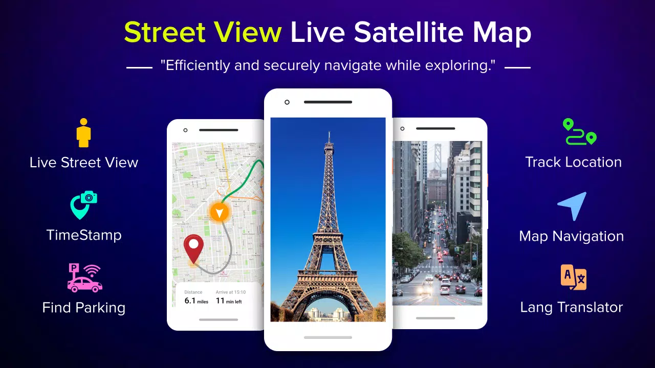
About Street View Live Satellite Map
Live Street View Satellite Map - A Comprehensive Guide
The "Live Street View Satellite Map" application is a powerful tool designed to help users explore the world through a combination of street map views, satellite imagery, and GPS navigation. Whether you're planning a trip, looking for nearby services, or simply wanting to discover new places, this app offers a wide range of features to meet your needs. With its intuitive interface and advanced functionalities, it serves as an all-in-one solution for navigating the globe.
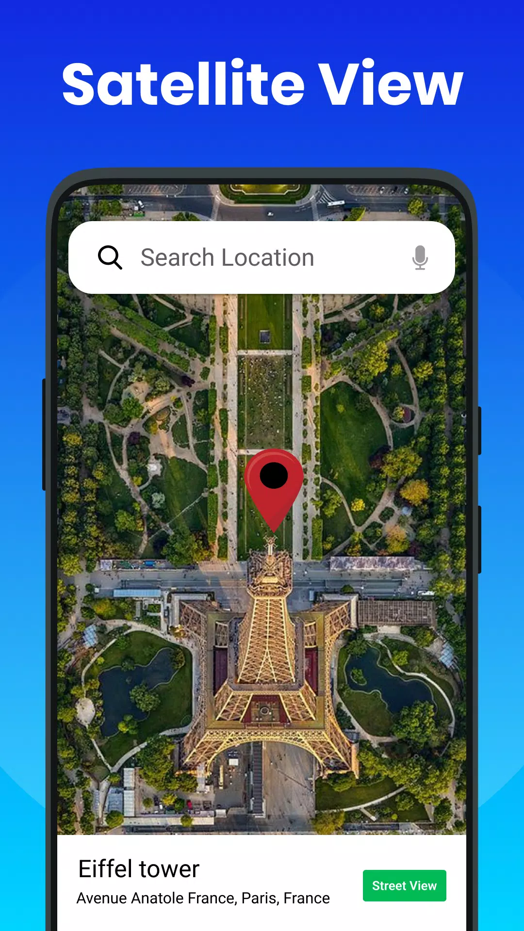
At the heart of the app lies its ability to provide real-time GPS tracking and detailed satellite imagery. Users can seamlessly switch between street maps and satellite views, allowing them to gain a comprehensive understanding of their surroundings. The app supports zooming capabilities, enabling users to explore areas in greater detail. Whether you're searching for landmarks, planning a road trip, or simply curious about a particular location, the app makes it easy to access high-resolution images and detailed maps.
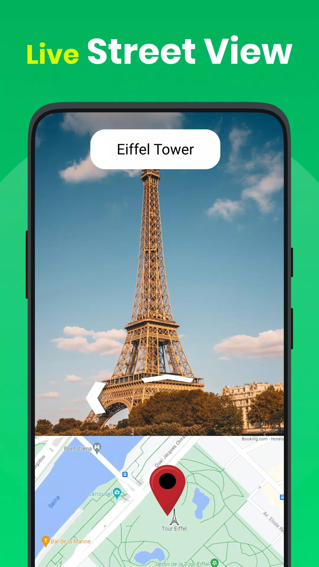
One of the standout features of the app is its 3D street map view, which provides a panoramic experience of the environment. This immersive view allows users to virtually walk through streets, making it ideal for those who want to familiarize themselves with a location before visiting. Additionally, the app offers a voice navigation system, making it easier to follow directions while driving or exploring unfamiliar areas. The voice-guided instructions ensure a hands-free experience, enhancing safety and convenience.
For those who frequently travel, the app includes a robust route planner feature. Users can input their starting point and destination to receive detailed driving or walking directions. The app even displays these routes in 3D, offering a clear visual representation of the path ahead. Real-time map guidance ensures that users stay on track, even in areas with complex road networks. Furthermore, the app provides updates on traffic conditions, helping users avoid congested routes and reach their destinations efficiently.
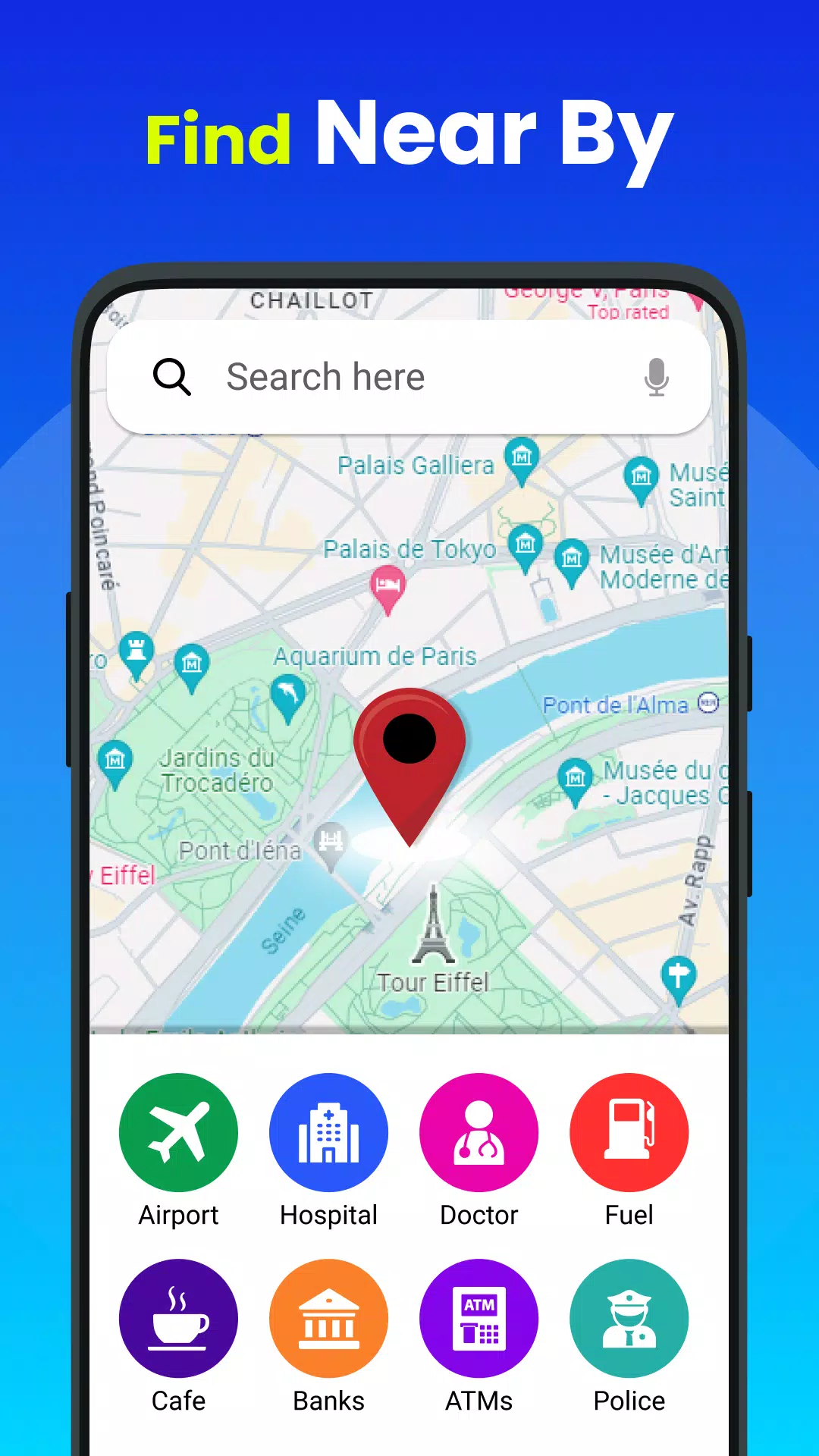
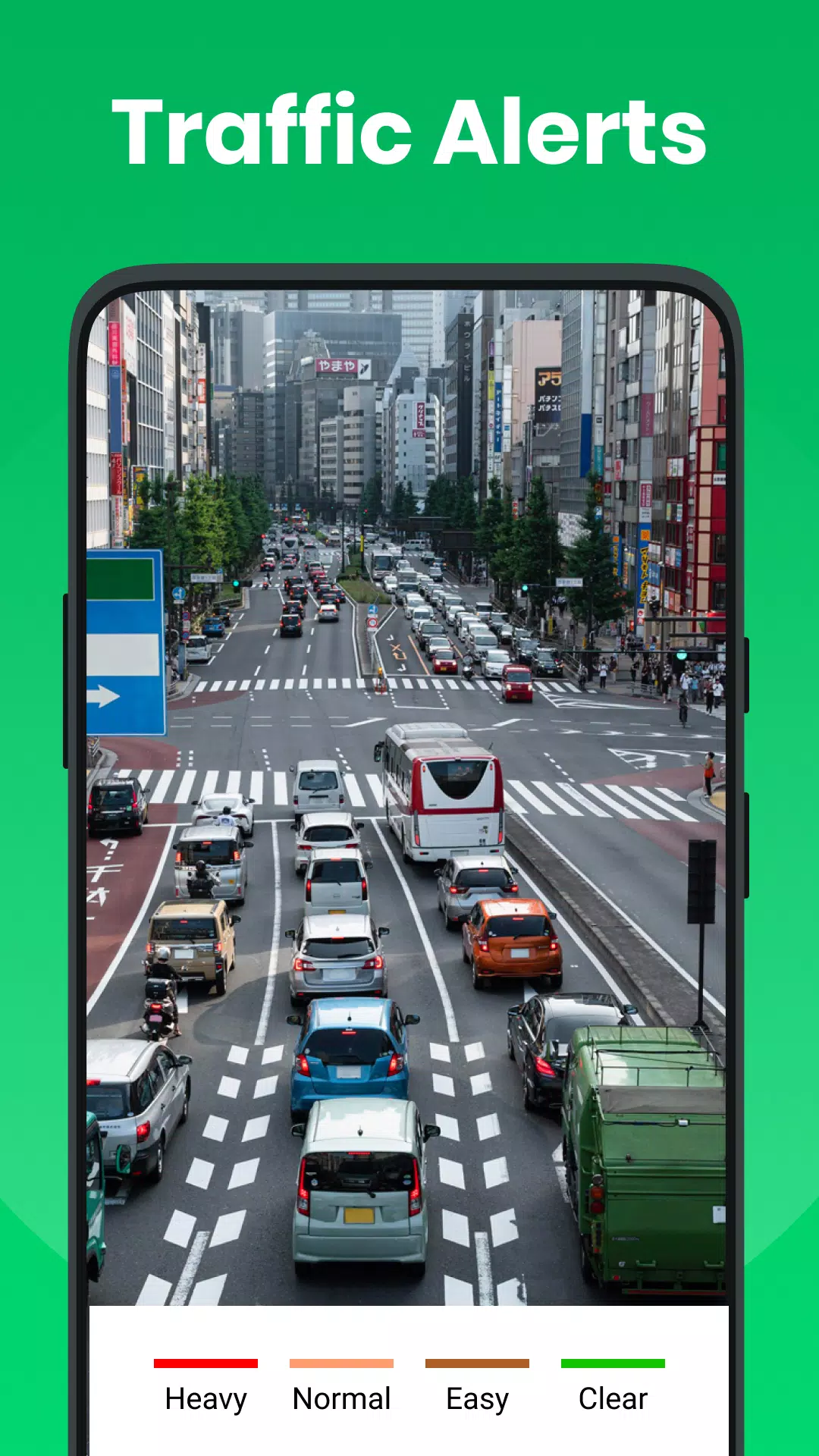
In addition to navigation, the app offers a variety of tools to enhance user experience. The "Nearby Places" feature helps users locate essential services such as hospitals, police stations, shopping centers, schools, and more. This functionality is particularly useful when traveling or exploring new areas, as it ensures that users have access to important amenities. The app also includes a traffic finder tool, which shares real-time updates on road conditions, enabling users to make informed decisions about their travel plans.
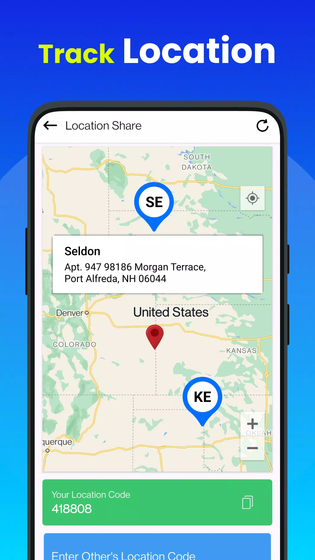
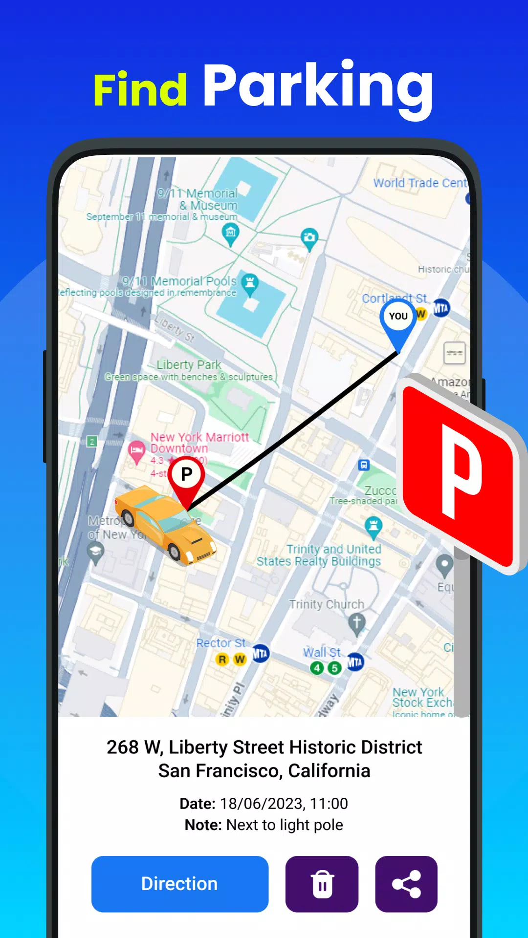
The app's "My Location" feature is another valuable asset, providing users with precise coordinates and addresses. This tool is especially helpful when users are unsure of their exact location or need to share their whereabouts with others. The ability to share your current location with friends and family adds an extra layer of convenience and safety during travels. Moreover, the app's compass feature acts as a digital guide, pointing users in the right direction and ensuring they stay oriented in unfamiliar environments.
Another notable aspect of the app is its area calculator tool, which allows users to measure distances and calculate the area of specific locations. This functionality is particularly useful for professionals, such as real estate agents or architects, who require accurate measurements for their work. The app also provides information about countries, including details about their geography, culture, and currency exchange rates. This global perspective makes the app an excellent resource for both casual travelers and business professionals.
For those interested in financial matters, the app includes a currency converter tool. This feature enables users to convert between different currencies, facilitating international transactions and travel. Additionally, the app offers a world time feature, allowing users to view the time in various countries and regions simultaneously. This function is particularly useful for individuals who frequently communicate across time zones or plan international meetings.
The app's extensive list of features includes a range of customization options. Users can choose from different map styles, including normal, satellite, and hybrid views, to suit their preferences. The app's compatibility with various devices ensures that users can access its features regardless of their device type. Its small size and friendly interface make it accessible to users of all ages and technical backgrounds.
In summary, the "Live Street View Satellite Map" app is a versatile tool that combines advanced mapping technology with user-friendly features. From its realistic street map views to its comprehensive navigation capabilities, the app caters to a wide range of needs. Whether you're a frequent traveler, a local explorer, or someone who simply enjoys discovering new places, this app offers a seamless and engaging experience. Download the app today to unlock the full potential of your GPS-enabled device and embark on countless adventures!
Street View Live Satellite Map Screenshots

Old Versions of Street View Live Satellite Map


Apps Like Street View Live Satellite Map
 Live Satellite Map Street View4.7
 Street View Live Map Satellite4.7
 Street View Live Satellite Map4.7
 Live Satellite View, Earth Map4.9
 Live Satellite View & GPS Map4.9
 Earth Map: Live Satellite View4.9
 Live Satellite View GPS Map4.9
 Live Earth Map: Street View 3D4.7
 Street View Earth Map Live GPS4.8
 Live Earth Map: Street View4.8
 Live Street View: World Map4.6
 Street View & Live Earth Map4.6