About MapPad GPS Land Surveys
Use MapPad to calculate areas, perimeters and distances and save, export or share your measurements.
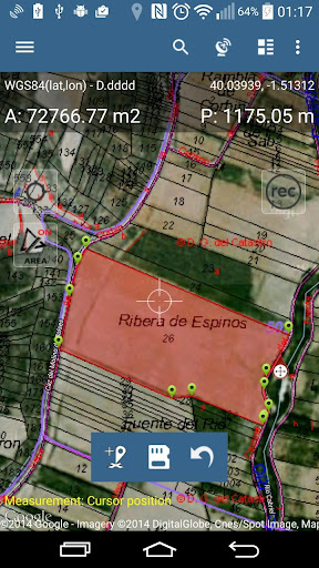
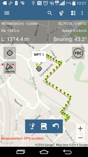
MapPad is providing multi-purpose mapping solution allowing location capture and determines distance and area for the shapes drawn on the map or captured using real-time GPS tracking.
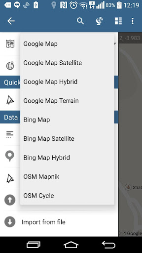
Calculate area of the field or a walk distance instantly using Google or Bing Map Satellite view. Save petrol and time and capture features with few clicks on the map.
With MapPad you can capture, manage and share your data easily.
MapPad is a very useful tool for anyone involved in forestry, agriculture, engineering and real estate management.
Please visit our website to find out how to prepare offline map and get more information about this product.
Selected features:
- Base maps: Google Maps, Open Street Map, Bing Maps
- Google Maps Overlays (Custom WMS or ArcGIS Server Tiled service), some layers like US Topographic map have been predefined.
- Very accurate measurement of areas and distances.
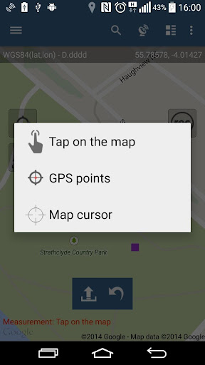
- 3 methods of measurement are supported (Tap on the map, GPS location, Map cursor location).
- Support for number of metric and imperial units.
- Support for several global and local coordinate systems, if you require support for any other spatial reference please get in touch.
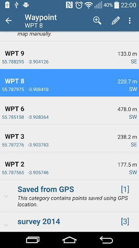
- Possibility to capture waypoints and group them in categories.
- Possibility to add or edit title and description for each recorded measurement and waypoint.
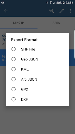
- Export single or multiple measurements or waypoints to SHP File, Geojson, ArcGIS Json, KML, GPX, CSV and DXF to SD Card or cloud services las well as direct export to Open Street Map.
- Share single waypoint location directly by SMS, E-mail or other ways.
- Elevation profile available for measurements done by GPS.
- Import of KML and GPX files to the application.
- GPS status and satellites status.
- Address, location search.
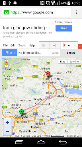
- Quick open exported KML files in Google Earth
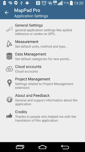
- Ability to set default measurement units, waypoints' categories colours, track recording time and distance interval, transparency of Google Maps overlays and much more...
Our users are successfully using MapPad in number of projects and applications.
MapPad GPS Land Surveys Screenshots
Old Versions of MapPad GPS Land Surveys
MapPad GPS Land Surveys FAQ
User Reviews
+ Reviews
Rating
Reviews
5
4
3
2
1
Most Popular

Digital Wellbeing4.7
See a complete picture of your digital habits and disconnect when you want to.Get a daily view of yo
Google Play Services for AR4.9
Google Play Services for AR is automatically installed and updated on supported devices. This servic
Clock4.8
The Clock app provides Alarm, World Clock, Stopwatch, and Timer features. Use the Clock app to manag
Samsung My Files4.6
[Introducing My Files] "My Files" manages all the files on your smartphone, just like a f
Device Care4.0
For a more pleasant experience while using your Galaxy smartphone, try the "Device Care" a
Samsung One UI Home4.0
Samsung Experience Home starts fresh with a new face and name: One UI Home. It comes with a simple s
Samsung Calculator4.2
[Key features]Perform four fundamental operations and engineering calculations.To start the engineer
Samsung Voice Recorder4.1
Samsung Voice Recorder is designed to provide you an easy and wonderful recording experience with hi
Samsung Email4.3
This update is available for Samsung Mobile with Android OS.Samsung Email enables users to manage mu
Crisis Action: 7th Anniversary4.6
Join in 7th Anniversary events to get free weapons now! Come back to enjoy the new version, brave th
Radiation City4.7
Radiation City Welcome to the world of Radiation City where a great survival adventure awaits you! F
Escape from Chernobyl4.6
Escape from Chernobyl is not an easy typical mobile game. It is hard and it takes time and tactics t
Batman: The Enemy Within4.6
In this latest chapter from the studio behind Batman - The Telltale Series, both Bruce Wayne and Bat
Art of Conquest : Airships4.9
[Five main races to satisfy players]Players can switch freely between five main races, Human, Dwarve
GTA: Liberty City Stories4.7
Download and play up to thirty minutes as a free trial.* Purchase the Liberty City Stories Full Gam
Doomsday: Last Survivors4.5
Doomsday: Last Survivors is a zombie survival game with multiplayer online competition and real-time
MARVEL Super War4.6
Marvel's first mobile MOBA game! Leap into battle in new Space War costumes for Iron Man and Captain
Warface GO: FPS Shooting games4.4
Dynamic battles await you in the universe of the world-famous Warface shooter! Enjoy various combat
Super Stylist Fashion Makeover4.4
There's a new fashion super stylist glow in town! In this fashion makeover hollywood story game make
Warpath: Ace Shooter4.2
Agent: Your assistance is once again required in the fight against Raven's tyranny. Your mission: To
Deemo4.4
"Never Left Without Saying Goodbye."The world acclaimed, mobile rhythm game that's touched
Lost Horizon4.9
[ The classic point ‘n click adventure by Animation Arts and Deep Silver FISHLABS comes to Google Pl
FINAL FANTASY VII4.0
Note:- As this application is very large, it will take some time to download.- This application take
Into the Dead 24.3
The sequel to the hit zombie action game Into the Dead (70+ million downloads)!Journey through the z

