About 3Dsurvey Pilot
3Dsurvey Pilot transforms your regular consumer drone into accurate surveying and mapping tool. A free addition to 3Dsurvey photogrammetry software, 3Dsurvey Pilot is the perfect tool to plan your missions and automatically capture images along with GPS data.
Post-flight processing of captured images is done easily with 3Dsurvey photogrammetry software, generating highly accurate, metric and geo-referenced results, such as dense point cloud, 3D mesh, topography map, elevation model, DSM, orthophoto. Perfect for any surveying professional.
Currently, the app supports the following drones:
• DJI
- Phantom 4 Pro V2
- Phantom 4 Pro
- Phantom 4
- Phantom 3 Professional
- Phantom 3 Advanced
- Mavic Air
- Mavic Pro
- Mavic 2 Pro
- Inspire 1 (Pro)
- Inspire 2
- Spark
Features and benefits:
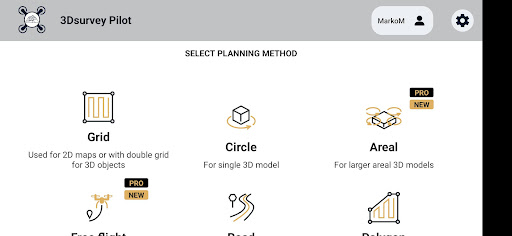
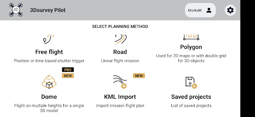
- Plan your mission - flight plans for different needs
---GRID
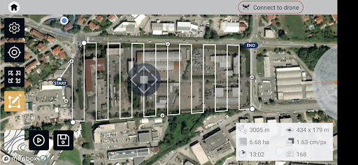
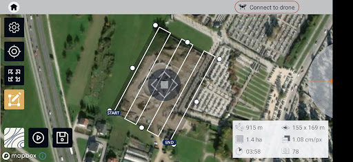
Single Grid or Double Grid for mapping of rectangle areas - the fastest way for planning routes with simple settings
---POLYGON
Mapping of advanced/irregular shaped areas - additional area shapes and advanced settings
---ROAD
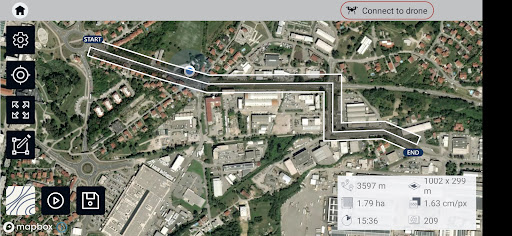
Developed specifically for simple and effective road, rail & corridor mapping
---CIRCLE
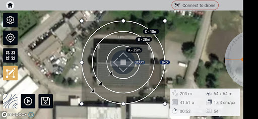
Circular mission for object mapping - always facing your point of interest for object 3D model reconstruction
---URBANSCAN
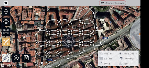
Best mission for 3D model of large urban area
---FREE FLIGHT
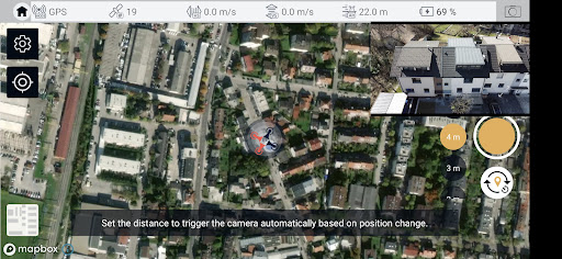
Position or time based shutter trigger. Works also with Mavic mini 2 and Air 2s
---DOME
Flight on multiple heights for single 3D object
- Automated drone flight & image acquisition
- Telemetry and live camera feed during the mission
- Simple workflow with 3Dsurvey's processing software
- Flight parameters for each mission - front & side image overlap, camera angle, flying height (AGL), flight speed - can be adjusted based on the requirements of the area and the project
- Advanced settings and options for demanding missions.
Post-flight processing & analysis using 3Dsurvey desktop software:
- Capture and recreate natural environment in digital form and survey from the office. Achieve high-resolution outputs with cm-grade accuracy.
- Use of Ground Control Points (GCPs) for improving the relative and absolute accuracy of the model
- Generate and modify:
--- Point clouds
--- Orthophotos
--- Digital 3D models (DSM, DTM, DEM)
--- CAD
--- Contour lines
--- Profiles and Cross sections
--- And more
- Measure:
--- Distances
--- Surfaces, Areas
--- Volumes
- Supports any drone & any camera/sensor. Works for aerial & terrestrial data acquisition methods. rTK- and EXIF GPS-ready for instant telemetry data import.
- 3Dsurvey is developed based on 300+ land surveying projects. Tailored to serve specific surveyors' needs. Cut fieldwork time by up to 100 times.
- Hybrid engine that utilizes both CPU and GPU for up to 15x faster image processing time. Large dataset support - 1000+ hi-res images.
- Compatible with third-party sources, data from LiDAR, Sonar, SLAM, terrestrial scanners. Seamless workflow for further combination with photogrammetric point clouds.
Usage information
Make sure you have the latest firmware installed and the app is up to date. The app follows the flight plan and does not avoid obstacles automatically.
3Dsurvey accepts no liability for damage, injuries or legalities from the misuse of this app. Use only in safe environments and follow your local drone regulation.
3Dsurvey Pilot Screenshots
Old Versions of 3Dsurvey Pilot
User Reviews
+ Reviews
Rating
Reviews
5
4
3
2
1
Most Popular

Digital Wellbeing4.7
See a complete picture of your digital habits and disconnect when you want to.Get a daily view of yo
Google Play Services for AR4.9
Google Play Services for AR is automatically installed and updated on supported devices. This servic
Clock4.8
The Clock app provides Alarm, World Clock, Stopwatch, and Timer features. Use the Clock app to manag
Samsung My Files4.6
[Introducing My Files] "My Files" manages all the files on your smartphone, just like a f
Device Care4.0
For a more pleasant experience while using your Galaxy smartphone, try the "Device Care" a
Samsung One UI Home4.0
Samsung Experience Home starts fresh with a new face and name: One UI Home. It comes with a simple s
Samsung Calculator4.2
[Key features]Perform four fundamental operations and engineering calculations.To start the engineer
Samsung Voice Recorder4.1
Samsung Voice Recorder is designed to provide you an easy and wonderful recording experience with hi
Samsung Email4.3
This update is available for Samsung Mobile with Android OS.Samsung Email enables users to manage mu
Crisis Action: 7th Anniversary4.6
Join in 7th Anniversary events to get free weapons now! Come back to enjoy the new version, brave th
Radiation City4.7
Radiation City Welcome to the world of Radiation City where a great survival adventure awaits you! F
Escape from Chernobyl4.6
Escape from Chernobyl is not an easy typical mobile game. It is hard and it takes time and tactics t
Batman: The Enemy Within4.6
In this latest chapter from the studio behind Batman - The Telltale Series, both Bruce Wayne and Bat
Art of Conquest : Airships4.9
[Five main races to satisfy players]Players can switch freely between five main races, Human, Dwarve
GTA: Liberty City Stories4.7
Download and play up to thirty minutes as a free trial.* Purchase the Liberty City Stories Full Gam
Doomsday: Last Survivors4.5
Doomsday: Last Survivors is a zombie survival game with multiplayer online competition and real-time
MARVEL Super War4.6
Marvel's first mobile MOBA game! Leap into battle in new Space War costumes for Iron Man and Captain
Warface GO: FPS Shooting games4.4
Dynamic battles await you in the universe of the world-famous Warface shooter! Enjoy various combat
Super Stylist Fashion Makeover4.4
There's a new fashion super stylist glow in town! In this fashion makeover hollywood story game make
Warpath: Ace Shooter4.2
Agent: Your assistance is once again required in the fight against Raven's tyranny. Your mission: To
Deemo4.4
"Never Left Without Saying Goodbye."The world acclaimed, mobile rhythm game that's touched
Lost Horizon4.9
[ The classic point ‘n click adventure by Animation Arts and Deep Silver FISHLABS comes to Google Pl
FINAL FANTASY VII4.0
Note:- As this application is very large, it will take some time to download.- This application take
Into the Dead 24.3
The sequel to the hit zombie action game Into the Dead (70+ million downloads)!Journey through the z

