Geo-Tagging Camera
About Geo-Tagging Camera
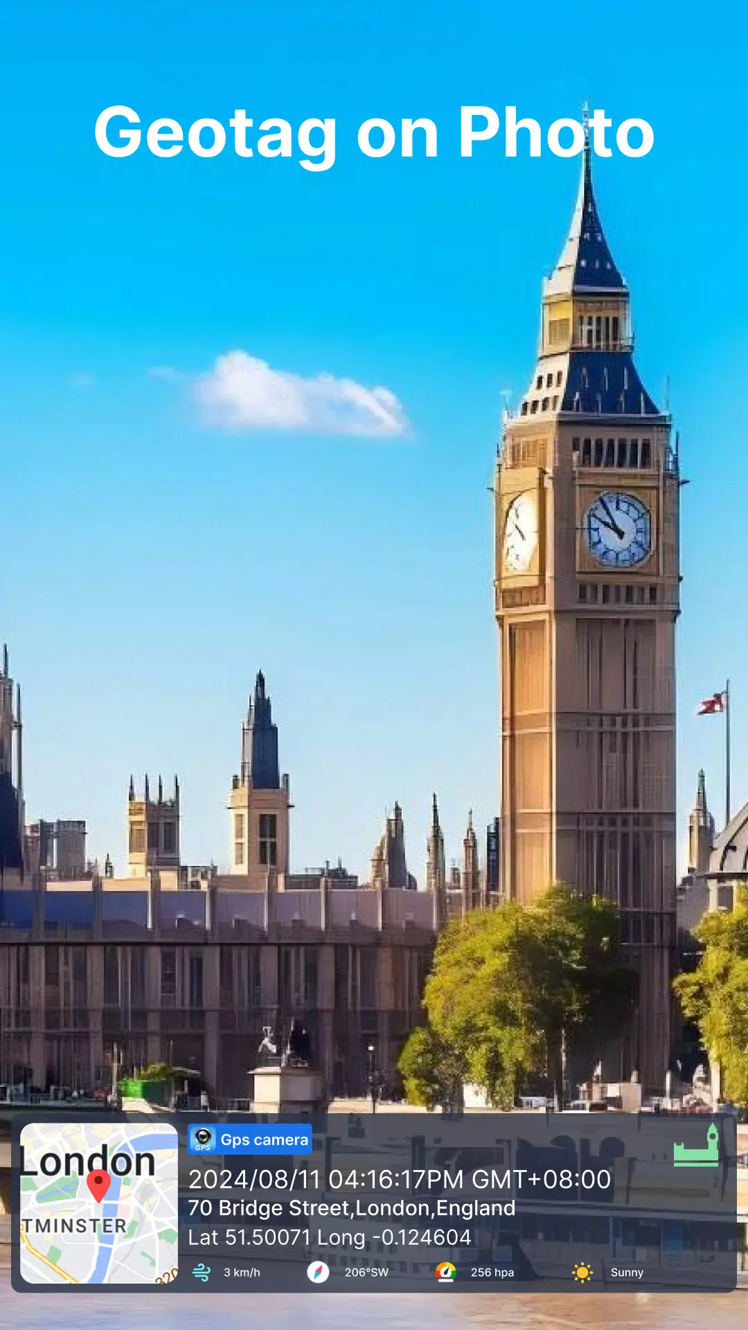
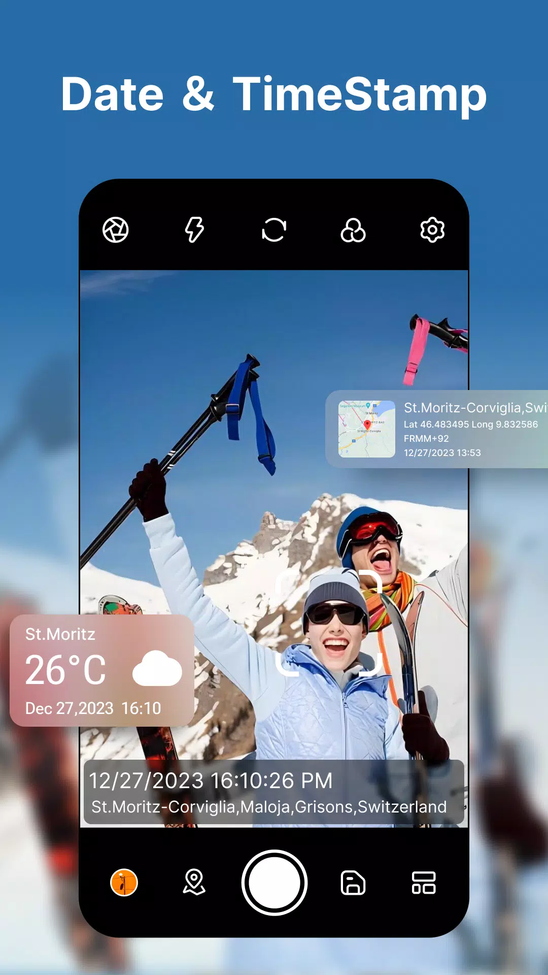
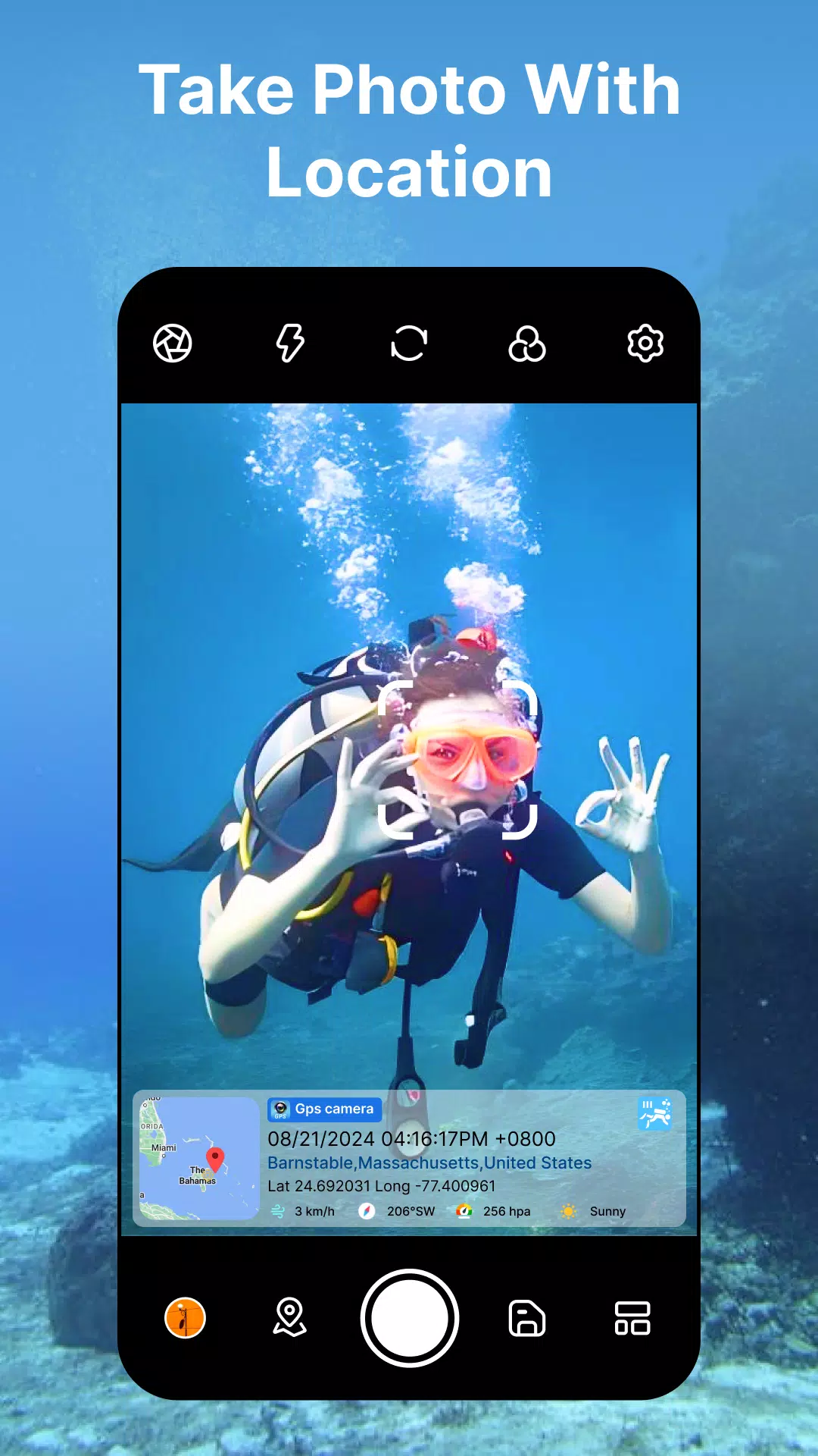
Geo-Tagging Camera: Capture Photos with Location, Map, Date, and Time
Geo-Tagging Camera is an advanced application that allows you to enhance your photos by adding detailed location information, along with other metadata such as map views, timestamps, and environmental data. Whether you're traveling, documenting a construction site, or simply capturing memories, this app provides comprehensive features to enrich your photo-taking experience.
Key Features
Geo-Tagging Camera offers a wide array of features designed to make your photos more informative and visually appealing:
- Automatically Fetched Stamp Details: The app automatically fetches geotags, date-time stamps, weather conditions, compass directions, and more.
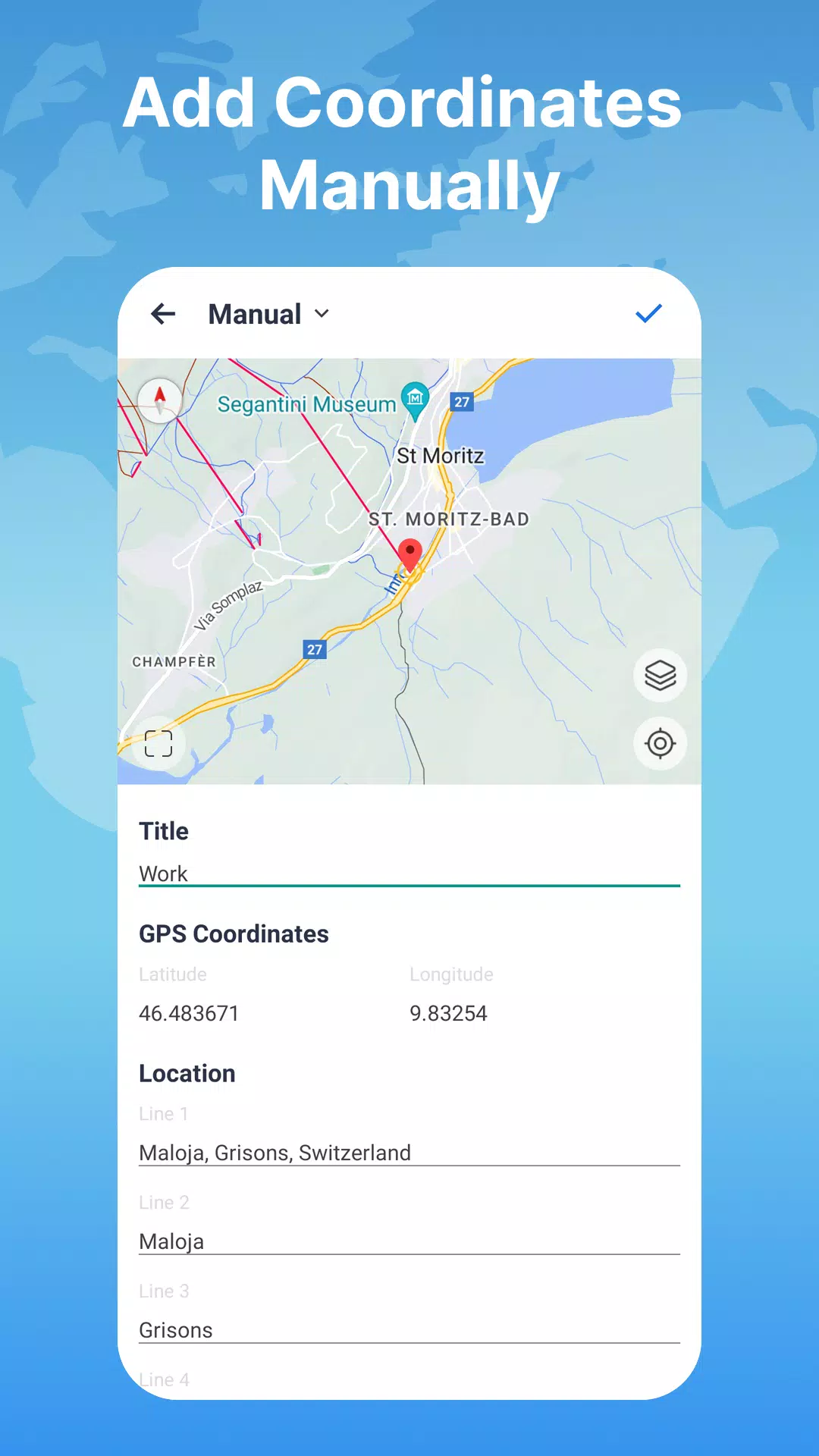
- Manual or Automatic Location Setting: You can set the location either manually or automatically based on your preference.
- Flexible Location Options: Choose a specific address or keep it general, ranging from a precise street address to a broader city-level location.
- Customizable Camera Interface: Customize your camera with features like grid lines, aspect ratios, front and selfie cameras, flash, focus, timer, white balance, HDR, level, and filters.
Comprehensive Metadata
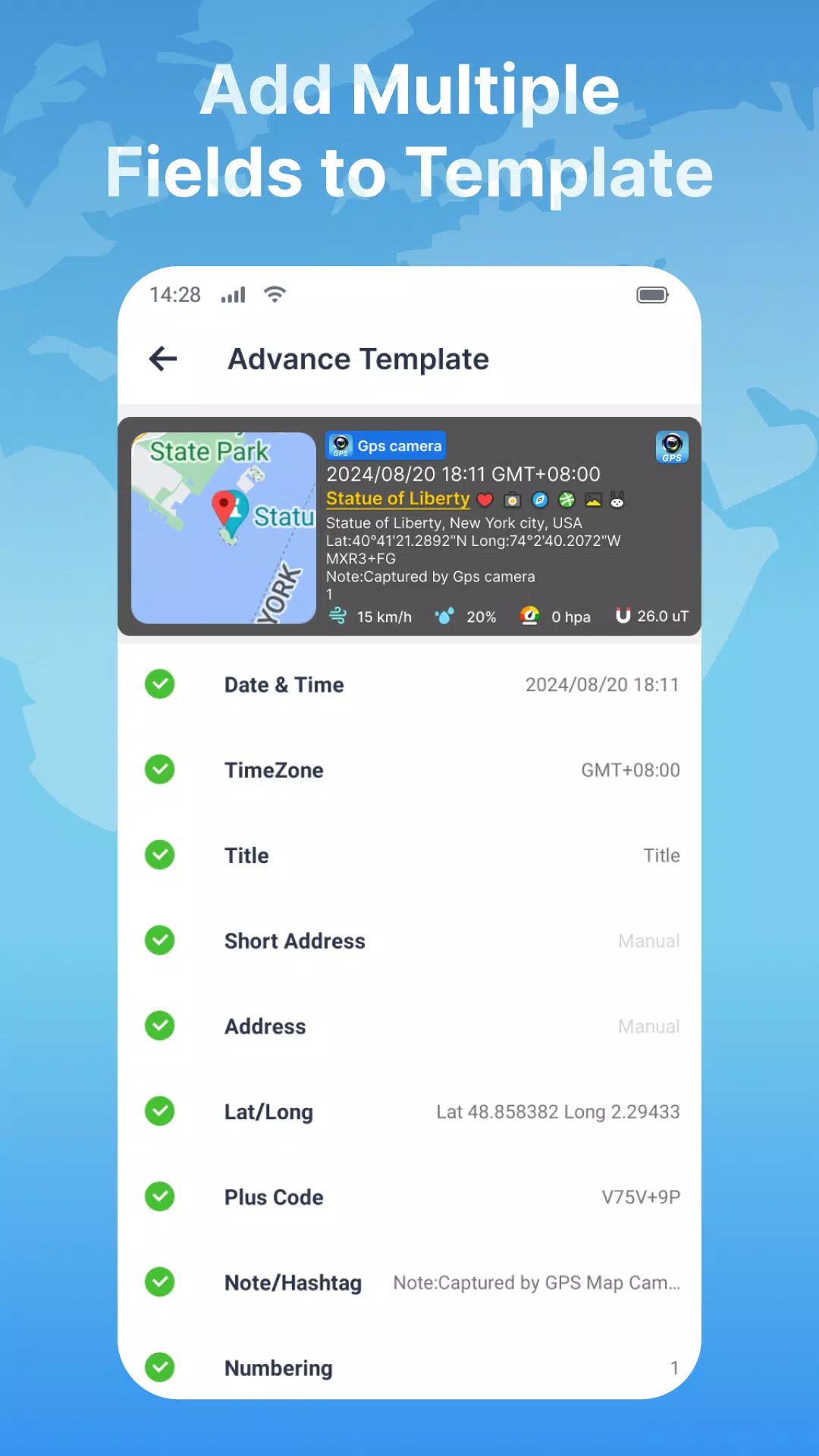
The Geo-Tagging Camera app includes a range of metadata fields that can be added to your photos:
- Map Type Options: Switch between Normal, Satellite, Terrain, and Hybrid maps to suit your needs.
- Logo Tag: Personalize your photos with your own logo or avatar.
- Date & Time: Add customizable date and time stamps to your images.
- Time Zone: Choose between GMT and UTC time zones.
- Title: Add a descriptive title to your photos.
- Short Address: Automatically add a brief location description.
- Address: Manually or automatically select your location.
- Lat/Long: Set GPS coordinates using DMS or decimal formats.
- Plus Code: Use accurate or concise location codes.
- Note/Hashtag: Write relevant notes and add hashtags.
- Numbering: Add sequential numbering to your photos.
- Weather: Display temperature in Fahrenheit or Celsius.
- Compass: Show auto-detected compass directions.
- Magnetic Field: Measure the magnetic field at the location.
- Wind: Measure wind speed.
- Humidity: Measure relative humidity.
- Pressure: Measure atmospheric pressure.
- Altitude: Automatically calculate altitude.
- Accuracy: Display accuracy of the location data.
Customization Options
The app also provides extensive customization options for your metadata:
- Font Style: Choose from a variety of font styles to fit your preferences.
- Color: Customize the color of your metadata text.
- Size: Select from large, medium, small, or extra-small text sizes.
- Position: Place your metadata at the top or bottom of the photo.
User-Friendly Experience
Using Geo-Tagging Camera is straightforward and intuitive. Simply click and save, and the app handles all the details for you. This makes it incredibly easy to share your location with friends and family or to have a handy tool in emergency situations where location data can be crucial.
Geo-Tagging Camera is your go-to app for enhancing your photos with rich metadata. Download it today and start capturing memorable moments with precision and detail!
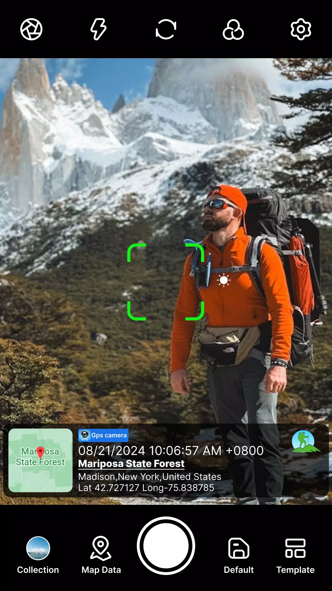
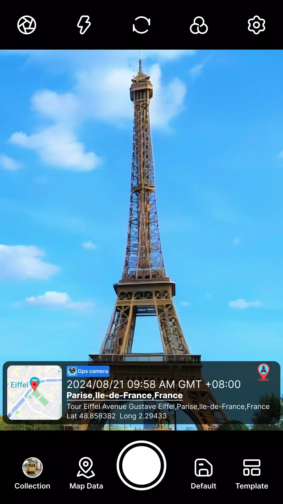
Geo-Tagging Camera Screenshots
Old Versions of Geo-Tagging Camera


Apps Like Geo-Tagging Camera
 Geotagging4.8
 HD Camera - Selfie Camera & Beauty camera4.9
 Beauty Camera - Selfie Camera4.6
 Beauty Camera X, Selfie Camera4.6
 Footej Camera - PRO HD Camera4.4
 Beauty Camera - Selfie Camera4.2
 DSLR HD Camera : 4K HD Camera4.7
 Beauty Camera:Selfie Camera HD4.6
 UVC Camera / Usb Camera custom4.7
 Beauty Camera - Selfie Camera4.8
 Beauty Camera - Sweet Camera4.8
 Beauty Camera - Selfie Camera4.9
Apps by Coocent
 DJ Mix Studio - DJ Music Mixer4.9
 LED4.9
 DJ Music Player - Vinyl Player4.9
 Ringtone Maker4.9
 Local Radar Weather Forecast4.8
 WaterRipple Live Wallpapers HD4.8
 Beauty Camera & Makeup Stylist4.7
 Equalizer & Bass Booster Pro4.7
 FastNotes4.7
 Geo-Tagging Camera4.7
 Bass Booster & Equalizer4.7
- Beauty Camera - Selfie Camera4.6