Tentang My Elevation: Altimeter App
Discover Accurate Elevation with My Elevation: Altimeter App
My Elevation: Altimeter App is the ultimate solution for those who need precise altitude measurements and want to track their current location accurately. Whether you're hiking, skiing, or mountain biking, this app provides you with real-time data on your altitude, elevation, and current geographical coordinates.
Key Features of My Elevation: Altimeter App
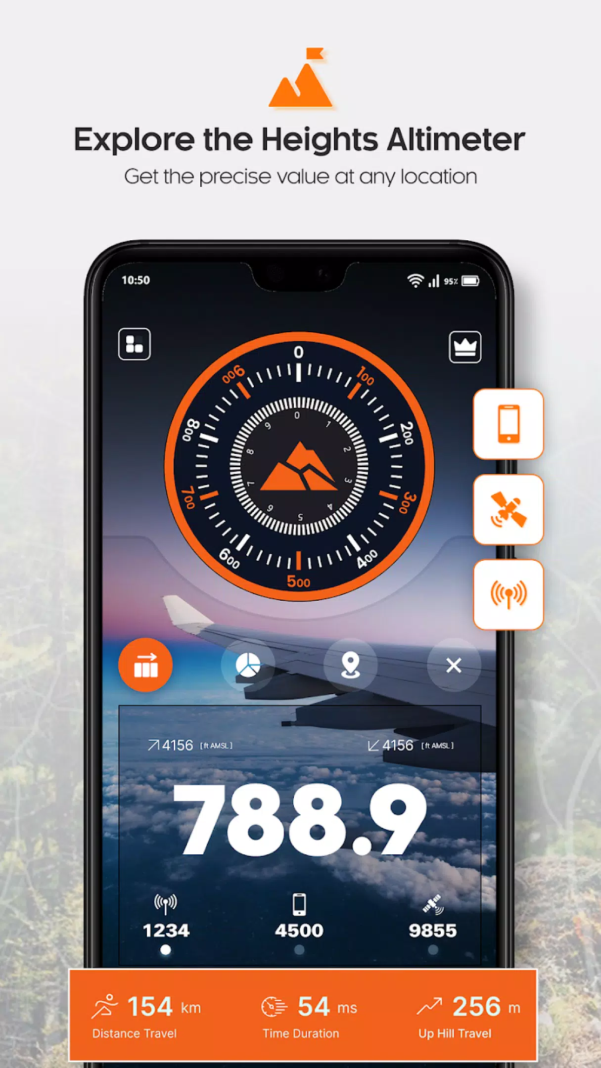
- GPS Altimeter: Get accurate altitude readings using the built-in GPS technology.
- Smart Digital Altimeter: Utilize a digital altimeter for quick and precise altitude calculations.
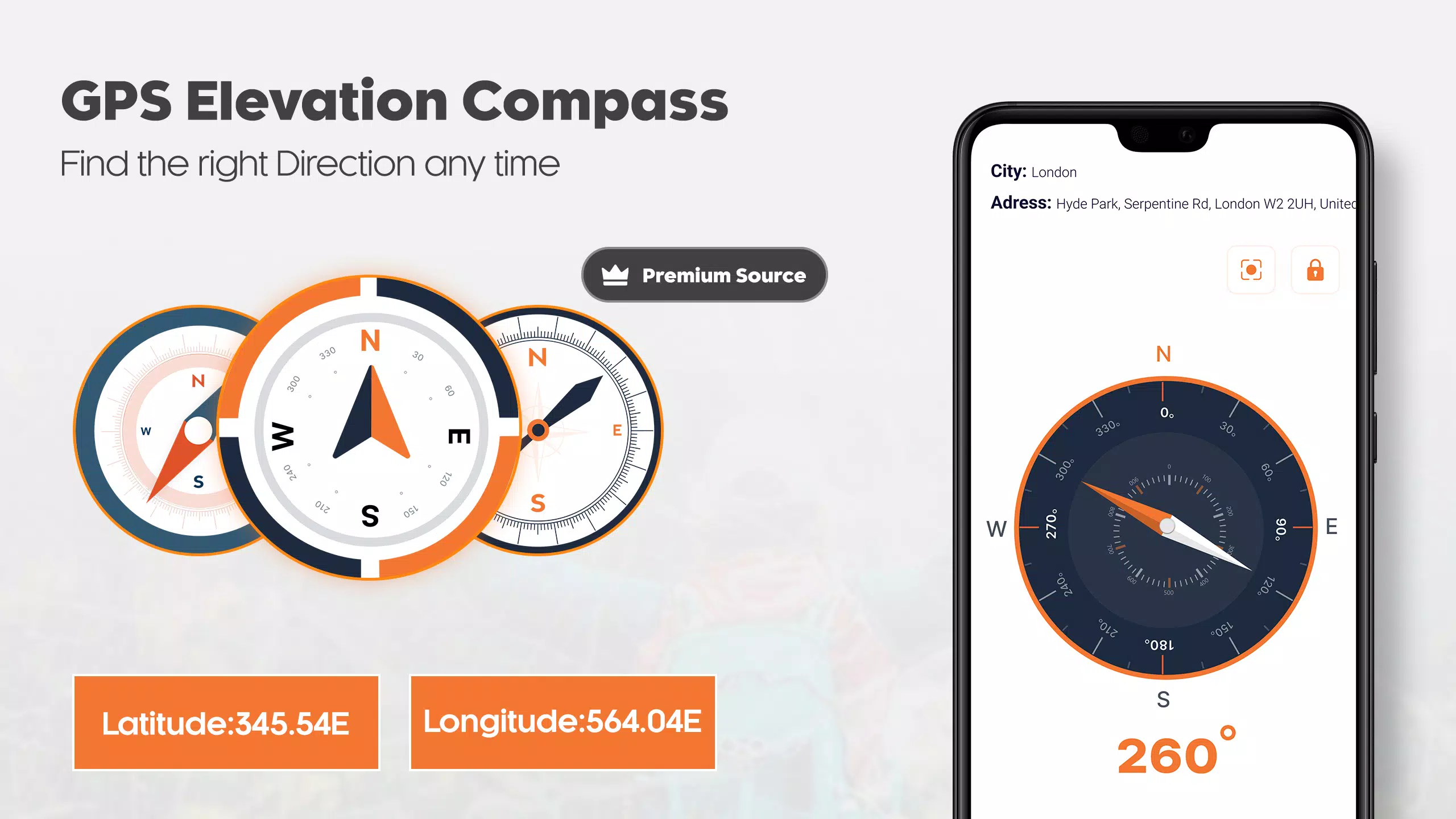
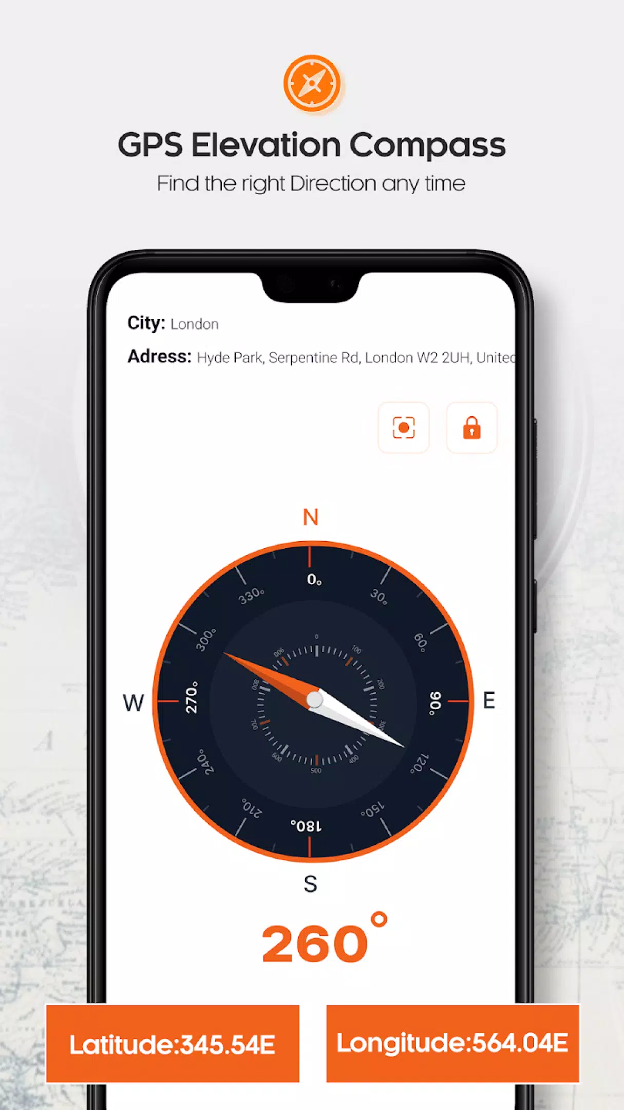
- True North GPS Compass: Find true north and determine your altitude above sea level.
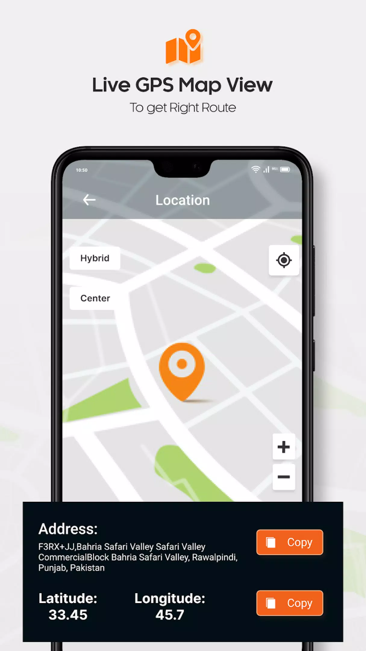
- GPS Map: Navigate through unknown terrains with ease using detailed GPS maps.
- Inclinometer: Measure the angle of slopes and ensure surfaces are perfectly horizontal or vertical.
- Bubble Level Meter: Ensure surfaces are perfectly level using the intuitive bubble level feature.
- Barometer: Measure atmospheric pressure and altitude accurately from anywhere.
Inclinometer: The Ultimate Tool for Surface Level Accuracy
The inclinometer in My Elevation: Altimeter App is a powerful tool designed to measure the incline and decline of surfaces. It helps you determine whether a plane or surface is perfectly horizontal or vertical. This feature is invaluable for anyone working with construction, engineering, or simply wanting to ensure their setup is perfectly level.
Digital Compass: Navigate with Precision
Equipped with a smart GPS compass, My Elevation: Altimeter App allows you to track your direction, longitude, latitude, and current location accurately. This digital compass is especially useful for hikers, mountaineers, and anyone engaging in outdoor activities. You can navigate to your saved locations and use the compass to find your way in unfamiliar territories.
Bubble Level Meter: Perfect for Surface Alignment
The bubble level meter included in the app is a handy tool for ensuring surfaces are perfectly horizontal or vertical. Designed to be simple and easy to use, it provides accurate level readings directly on your smartphone. Whether you're setting up equipment or just need to ensure something is level, this feature is incredibly useful.
Barometer: Measure Atmospheric Pressure and Altitude
The barometer in My Elevation: Altimeter App measures both atmospheric pressure and altitude accurately. This feature is particularly useful for outdoor enthusiasts who need to know their exact height above sea level. With this information, you can better understand weather patterns and terrain changes.
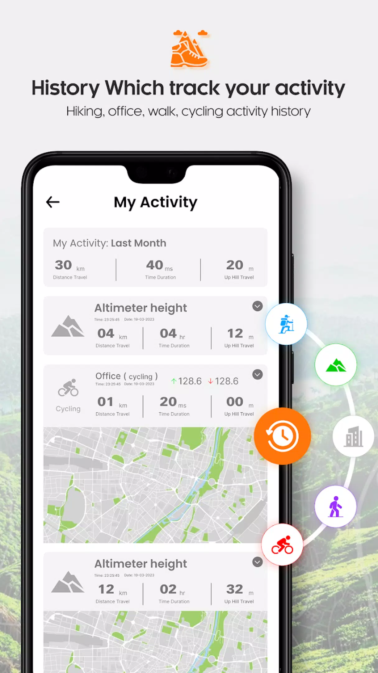
GPS Map: Track Your Route with Ease
The GPS map feature in My Elevation: Altimeter App allows you to track your route with ease. Use the navigation tools to explore new areas, track your movements, and plan your routes efficiently. The user-friendly interface ensures that you can navigate through unfamiliar places with confidence.
Experience the power of precision with My Elevation: Altimeter App. Download now and start exploring the world with confidence and accuracy!